TALLAHASSEE, Fla. (WCTV) – The Atlantic 2025 hurricane season has felt slow to start, which is ordinary, through early August. Climatologically, the tropics begin to heat up in mid-August and peak in September.
The National Hurricane Center is monitoring a cluster of showers and storms in the middle of the Atlantic Ocean that is unlikely to develop over the next two days as the disturbance fights unfavorable conditions.
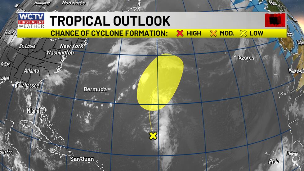
A weak cluster of storms has a low chance at becoming an organized tropical system.(WCTV)
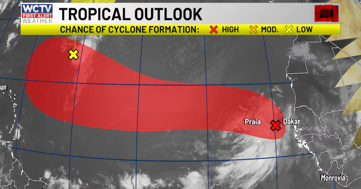
Nearly 4,000 miles from North Florida and South Georgia, a tropical wave is located off the African coast. The disturbance, Invest 97L, has numerous thunderstorms and some circulation.
The NHC has an 80% chance that 97L will develop into an organized tropical system over the next 7 days. Model guidance suggests a more organized tropical system is likely next week.
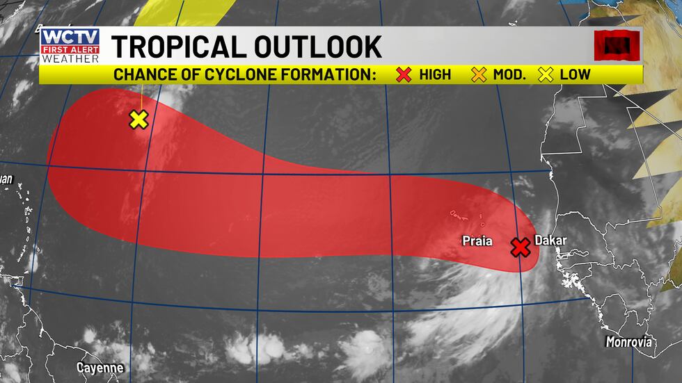
A tropical wave is likely to develop into an organized tropical cyclone over the next few days.(WCTV)
Once the invest develops into a tropical depression or potential tropical cyclone, the National Hurricane Center will issue a cone. Until then, model data will be limited to global models and spaghetti plots, which can struggle during the early stages of tropical development. While current data is helpful, data and forecasting skills improve once hurricane hunters go into the area of disturbed weather.
Here are the spaghetti models from Invest 97L over the next few days:
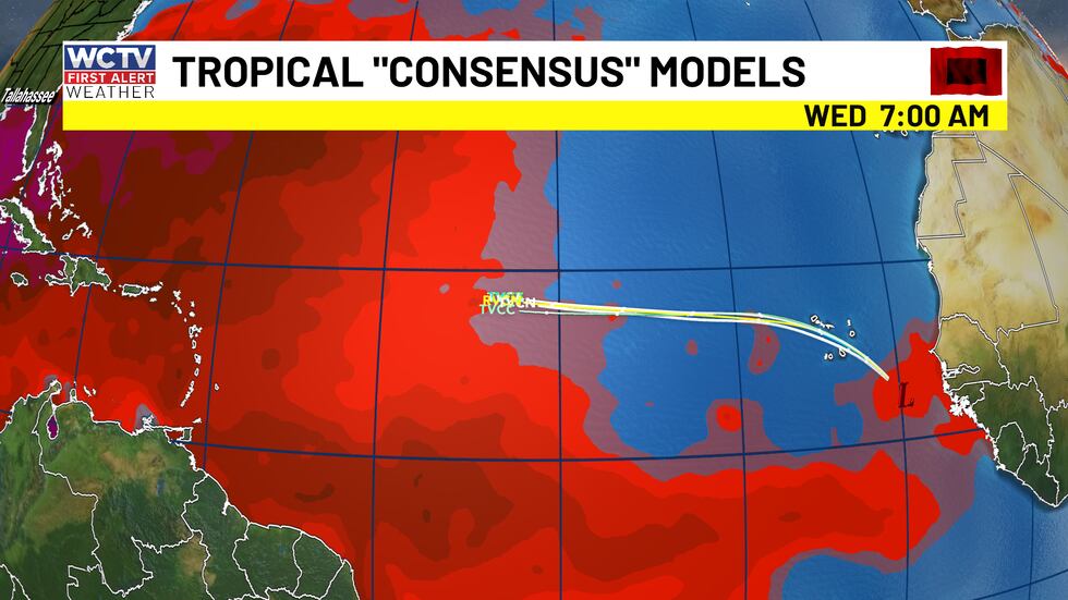
A slow westward track over the next few days, moving into more favorable environment by Wednesday.(WCTV)
The tropical wave will be fighting off some Saharan Dust during its initial development period.
There are no concerns for North Florida or South Georgia today, Invest 97L. The early model guidance wants to curve the storm away from the east coast of the United States. This storm has the potential to be the first hurricane in the Atlantic this year. According to the National Hurricane Center, the first hurricane typically develops in early to mid-August.
We will watch, wait and see how this evolves over the next week or two. There is no need to panic right now.
One last area that I am keeping my eyes on, the southwest Florida coast. Although there is no official forecast by the NHC, the area of thunderstorms is over open warm waters. Whether it becomes an organized tropical system or not, heavy rainfall with it can be expected across the Gulf Coast.
With the peak of hurricane season approaching, we want you to be weather aware, prepared and not scared for the peak of hurricane season. We are always watching every model run, every hour, every day to ensure your safety.
Know that as we head into the peak of hurricane season, the WCTV First Alert Weather team has your back.
We have plenty of free tools to track the weather with us:
- The FREE WCTV Weather App
- Weather Articles and updates on the web
- First Alert Daily Weekdays at 2:00 p.m.
- First Alert Weather NOW for 24/7 access to WCTV’s weather
To stay updated on all the latest forecasts and weather, follow WCTV First Alert Weather on Facebook and X (Twitter).
Click here to see all the latest weather headlines and here to view the First Alert Radar. Receive push alerts and watch the latest forecast anytime on the free WCTV First Alert Weather app. Click here to download it now.
Interested in becoming a WCTV First Alert Weather Watcher? Click here to join the team!
Copyright 2025 WCTV. All rights reserved.