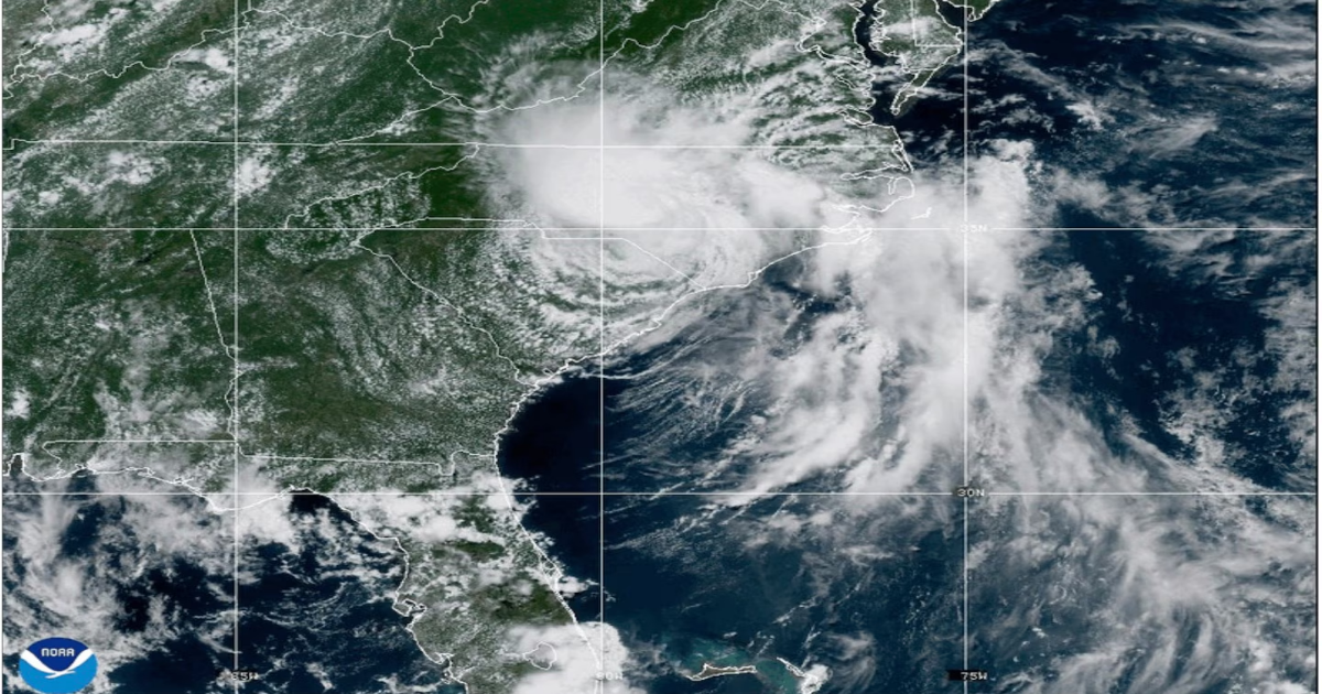
As Tropical Depression Chantal moved over North Carolina on Sunday night, the storm flooded cities and towns, closed hundreds of roads and left dozens of residents stranded, prompting water rescues and evacuations.
After making landfall early Sunday in South Carolina, the storm struck a narrow part of central North Carolina as a tropical depression, delivering two months’ worth of rain and inundating Chapel Hill, Durham and the surrounding towns. Four tornadoes were also reported in the state, including one that damaged hangars and aircraft at Raleigh Executive Jetport.
As of Monday morning, there were no reports of fatalities or injuries, and authorities said floodwaters had begun to recede in some places. More than 23,000 households across the state were still without power, according to poweroutage.us, which tracks data from utility companies.
In Chapel Hill, the city fire department and neighboring agencies conducted more than 50 water rescues overnight, city officials said in a 4:30 a.m. update Monday, as floodwaters entered or threatened apartments and condominiums. More than 60 residents were displaced by the flooding.
Authorities in Orange County, which includes Chapel Hill, declared a state of emergency Sunday night, writing on social media that the storm had caused “widespread flooding, power outages, and hazardous road conditions.” By Monday morning, about a quarter of the county’s residents were without power and officials had opened a reception center where people displaced by the flood could get blankets and bottled water.
In the nearby town of Haw River, the National Weather Service reported “major flooding” as the town’s river of the same name crested early Monday. At one point, the river reached 32.5 feet — the highest reported by the agency since Hurricane Fran in 1996, when the river reached 32.83 feet.
Heavy rainfall in Durham caused the Eno River to overflow its banks. The Durham Fire Department said emergency workers rescued about 80 people by boat overnight, while many more evacuated on foot. According to local news reports, many of the rescues took place at homes on the nearby Rippling Stream Road, where the rising river filled houses with chest-deep water and caused cars to float down the street.
By midmorning Monday, Chantal’s speed had slowed. Yet forecasters said they remain concerned about flash flooding across parts of south-central and eastern Virginia, southern and eastern Maryland, Delaware, southern New Jersey and southeastern Pennsylvania.
More thunderstorms are expected in central North Carolina on Monday afternoon. “Rivers, creeks and streams will remain elevated, fast moving and dangerous over the next few days,” the National Weather Service warned Monday morning on social media.
Life-threatening surf conditions are expected to continue at beaches from northeastern Florida to the Mid-Atlantic over the next day, according to the National Hurricane Center.