CHARLESTON, S.C. (WCSC) – The tropical depression near the South Carolina Coast has officially been upgraded to Tropical Storm Chantal.
The tropical depression near the South Carolina Coast has officially been upgraded to Tropical Storm Chantal.(Live 5)
The National Weather Service says the Tropical Storm Watch has been upgraded to a Tropical Storm Warning from the South Santee River to Surf City, North Carolina. A Tropical Storm Watch remains in effect from Edisto Beach to the South Santee River.
A Tropical Storm Warning means that tropical storm conditions are expected somewhere within the warning area, in this case within the next 12 to 24 hours.
A Tropical Storm Watch means that tropical storm conditions are possible within the watch area, in this case within the next 12 hours.

The National Weather Service says the Tropical Storm Watch has been upgraded to a Tropical Storm Warning from the South Santee River to Cape Fear in North Carolina. A Tropical Storm Watch remains in effect from Edisto beach to the South Santee River.(Live 5)
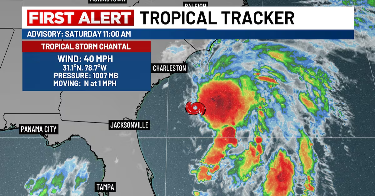
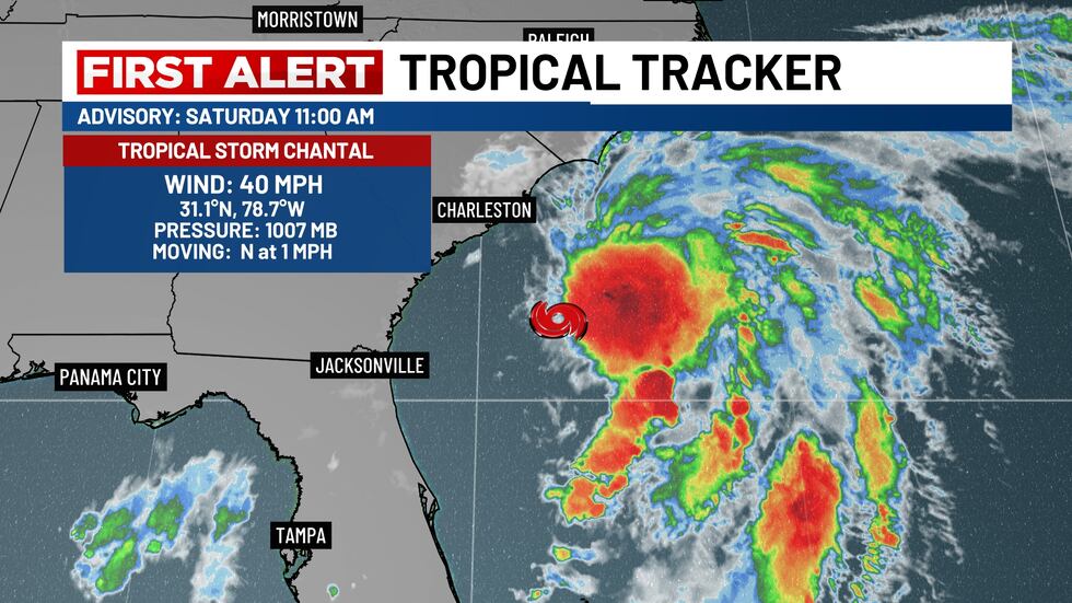
As of 11 a.m., the center of Tropical Storm Chantal was located near latitude 31.1 North, longitude 78.7 West, or about 135 miles south southeast of Charleston.
The storm is moving slowly toward the north near 1 mile per hour. A slow motion toward the north-northwest is expected to begin later today, followed by a turn to the northeast by Sunday night.
On the forecast track, the center of Chantal is expected to move across the coast of South Carolina Sunday morning. Maximum sustained winds have increased to near 40 mph with higher gusts. Some additional strengthening is expected before Chantal reaches the coast.
Tropical-storm-force winds extend outward up to 90 miles primarily to the east of the center. The estimated minimum central pressure is 1007 mb or 29.74 inches.
Copyright 2025 WCSC. All rights reserved.