There are two tropical trouble spots being monitored by the National Hurricane Center in the Atlantic basin.
One has a low development chance and will stay well away from land, posing no threats.
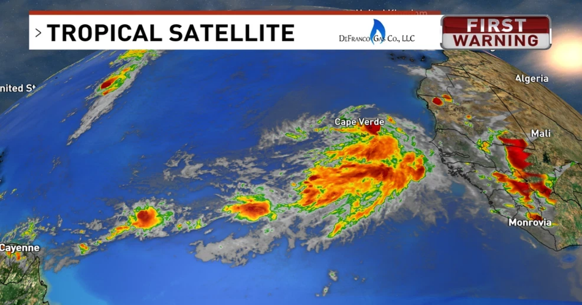
The other is a tropical wave moving off the coast of African that is expected to move into a supportive environment for further development as it tracks west over the next few days.
Showers and storms near the Cabo Verde Islands are becoming more organized around a low-pressure system. If it strengthens just a bit more, it could become a tropical depression as it moves through the islands Sunday night into Monday.
Even if it doesn’t form right away, conditions look good for development later this week, and it will likely become a tropical depression or storm as it moves west to west-northwest across the Atlantic at 15–20 mph.
Models are giving the system a healthy chance to become our first hurricane of the 2025 season, but where it will go is still uncertain.
Different models say different things of what it will do once it gets closer to land. Some have it curving out to sea, some don’t. As of Sunday, upper air patterns in that timeframe did favor a curve away from the States. Although, it is still 10+ days before we would have any run-ins with this, and long range forecasts can’t be trusted at this time.
Here’s the spaghetti models as of Sunday night, where it tracks west. Where it will go from that point, we do not know, and can’t say so.
As we head into the week, we will know more as the forecast matures.
In the meantime, we have no tropical threats to the Gulf coast for now.