Saturday July 5 Late Afternoon Update
Tropical Storm Chantal officially was named earlier today and has be working towards and US landfall tomorrow. This is the third named storm of the season, and if you think you missed the other two, you didn’t miss much. Andrea was in the North Atlantic and Barry was in the Gulf that landed on Central Mexico. Both of them lasted less than 24 hours.
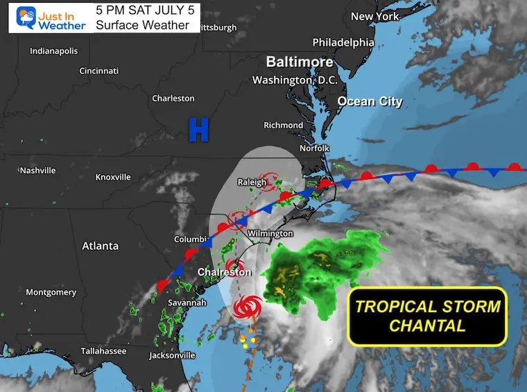
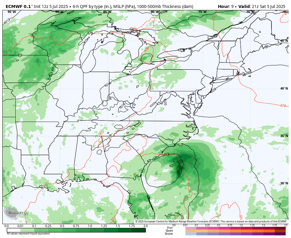
This new storm is located off of the Southeast US coast with sights on coastal North Carolina. With it will bring locally heavy rain, thunderstorms up the coast, and rip currents up the East Coast.
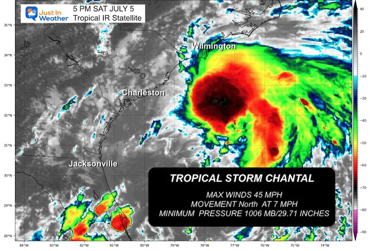
Winds are 45 mph, but it is a lopsided storm with most of the convection (thunderstorms) located well east of and exposed center. That means it does not support much development.
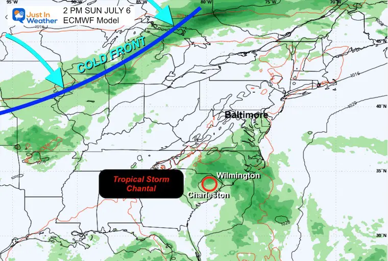
While I am tracking the path and impact into the Mid Atlantic through Monday, there will be tropical thundershowers into Maryland and Delaware.
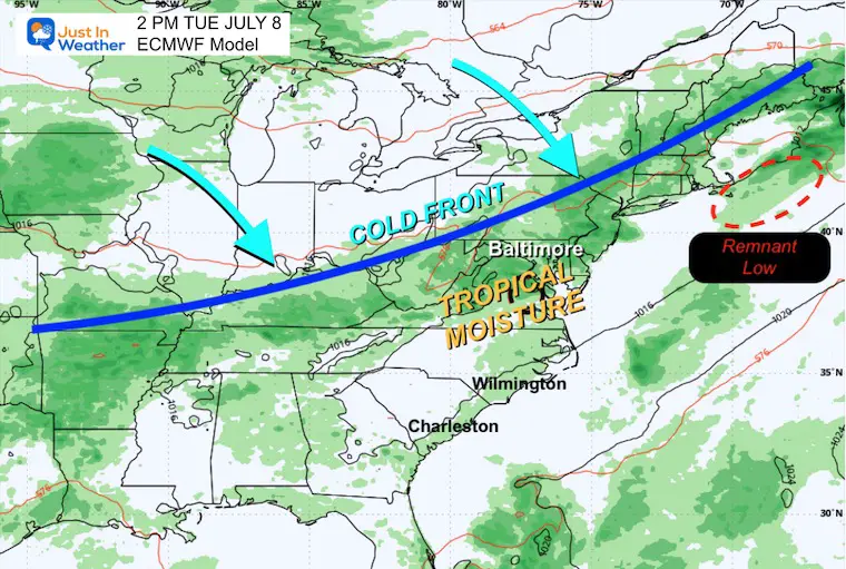
I think the left over tropical moisture will interact with a cold front that will result in more widespread thunderstorms Tuesday and Wednesday, after the remains of Chantal are well off the coast.
Live Radar and Lightning Widget
Surface Weather
With max winds of 45 mph, the center was located about 95 miles southeast of Charleston, SC.
5 PM Advisory from the National Hurricane Center
- LOCATION…31.9N 78.7W
- ABOUT 95 MI…150 KM SE OF CHARLESTON SOUTH CAROLINA
- ABOUT 165 MI…270 KM SSW OF WILMINGTON NORTH CAROLINA
- MAXIMUM SUSTAINED WINDS…45 MPH…75 KM/H
- PRESENT MOVEMENT...N OR 360 DEGREES AT 7 MPH…11 KM/H
- MINIMUM CENTRAL PRESSURE…1006 MB…29.71 INCHES
Satellite Images
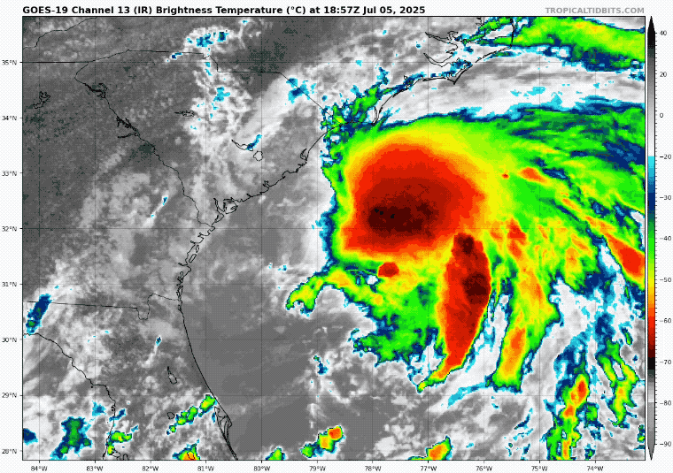
Tropical IR Satellite
This shows the highest cloud tops color enhanced.
Tropical Storm Force Winds EXTEND 140 miles demo the center.
Tropical IR Satellite Loop
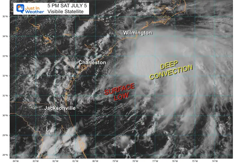
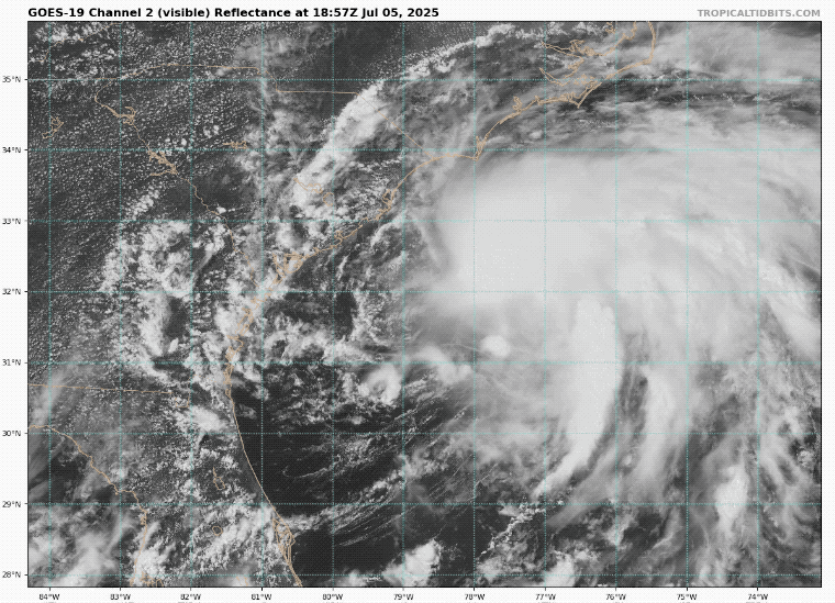
Visible Satellite
This is the raw daylight view from space. This shows the exposed center to the West of the thunderstorms.
Tropical IR Satellite Loop
This may help show the circulation better with reference.
National Hurricane Center Forecast Track
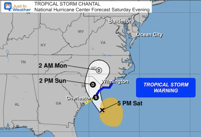
SUMMARY OF WATCHES AND WARNINGS IN EFFECT:
A Tropical Storm Warning is in effect for…
* South Santee River, SC to Surf City, NC
A Tropical Storm Watch is in effect for…
* Edisto Beach to South Santee River, SC
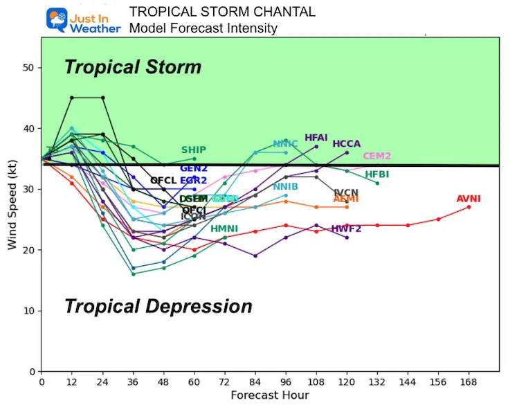
Computer Model Forecast Intensity
There is likely to be no more strengthening then RAPID WEAKENING when making landfall.
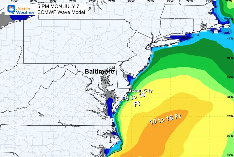
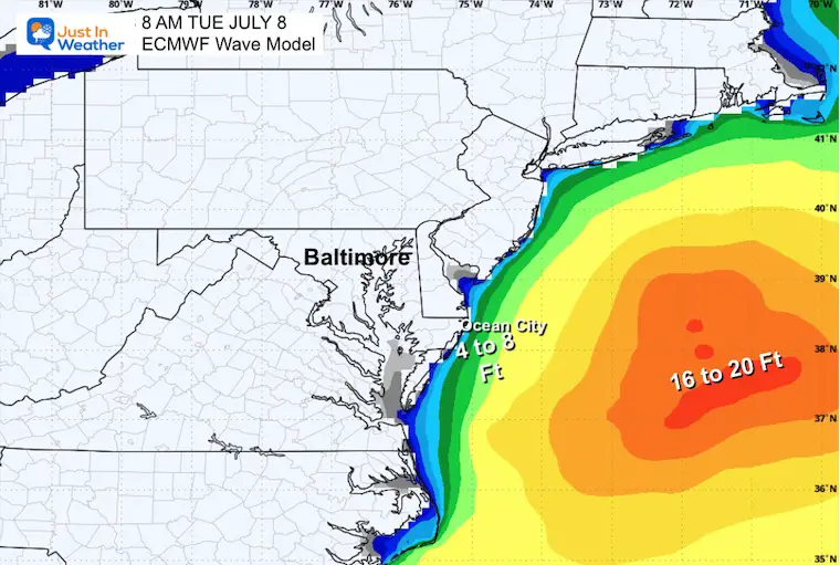
Wave Forecast Model
Rip Currents will occur, but the highest waves will remain well off shore.

Snapshot Monday
Snapshot Tuesday
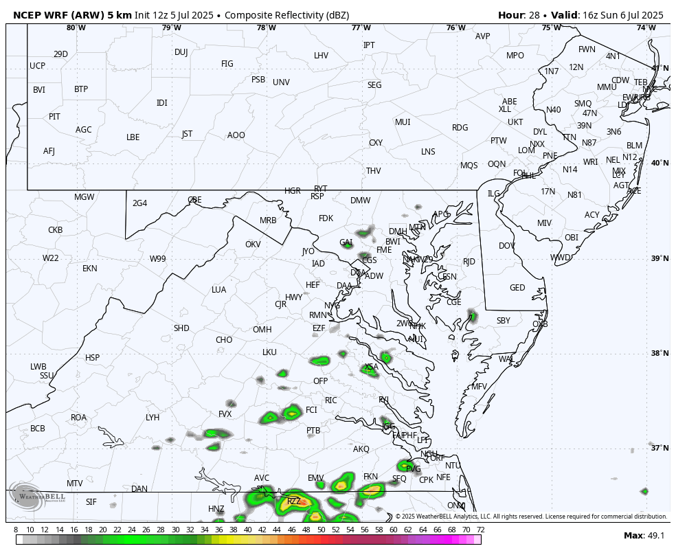
Radar Simulation NCEP WRF Model
Sunday Noon to 8 AM Monday
Snapshots
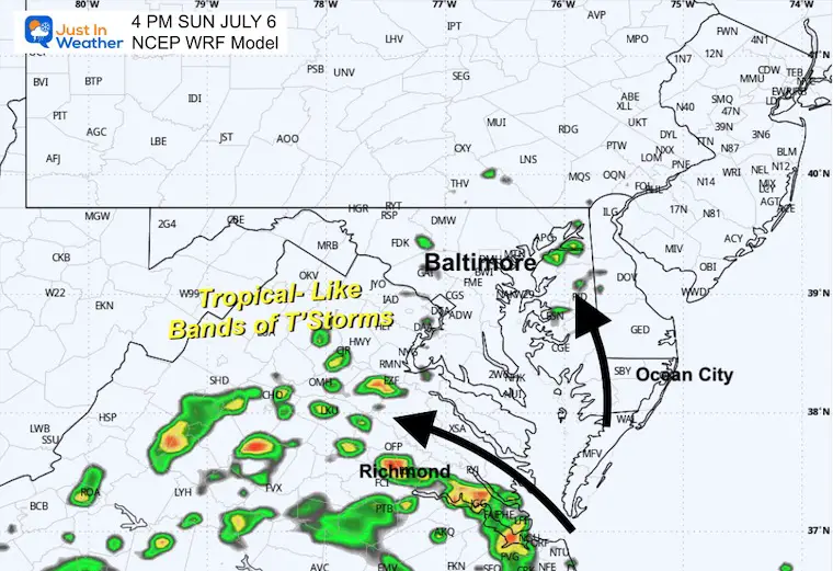
4 PM Sunday
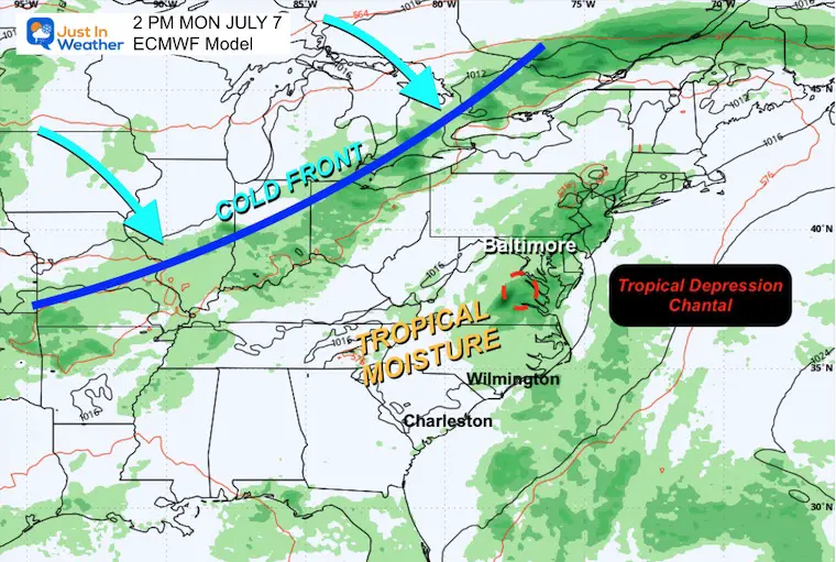
The waves of energy will interest with daytime heat to produce some thundershowers. The main energy will lass into Southern Virginia.
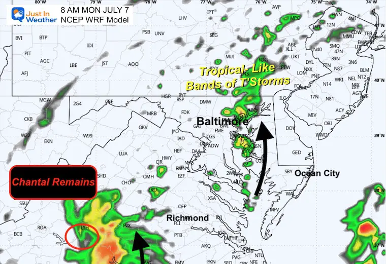
8 AM Monday
Some banding of tropical enhanced thunderstorms may be expanding through the day as the remnant low tracks through Southern Maryland and off the coast.
It is likely to be a tropical depression at that time.
Wide View Forecast
As I mentioned above, I think there will be enhanced tropical moisture in place to interact with the approaching cold front Tuesday and Wednesday to produce more widespread heavy thunderstorms
Saturday to Wednesday
Snapshots
Sunday
Monday
Tuesday
Subscribe for eMail Alerts
Please share your thoughts and best weather pics/videos, or just keep in touch via social media.
THANK YOU:
Baltimore Sun Magazine Readers Choice Best Of Baltimore
Maryland Trek 11 Day 7 Completed Sat August 10
We raised OVER $111,000 for Just In Power Kids – AND Still Collecting More
The annual event: Hiking and biking 329 miles in 7 days between The Summit of Wisp to Ocean City.
Each day, we honor a kid and their family’s cancer journey.
Fundraising is for Just In Power Kids: Funding Free Holistic Programs. I never have and never will take a penny. It is all for our nonprofit to operate.
Click here or the image to donate:

RESTATING MY MESSAGE ABOUT DYSLEXIA
I am aware there are some spelling and grammar typos and occasional other glitches. I take responsibility for my mistakes and even the computer glitches I may miss. I have made a few public statements over the years, but if you are new here, you may have missed it: I have dyslexia and found out during my second year at Cornell University. It didn’t stop me from getting my meteorology degree and being the first to get the AMS CBM in the Baltimore/Washington region. One of my professors told me that I had made it that far without knowing and to not let it be a crutch going forward. That was Mark Wysocki, and he was absolutely correct! I do miss my mistakes in my own proofreading. The autocorrect spell check on my computer sometimes does an injustice to make it worse. I also can make mistakes in forecasting. No one is perfect at predicting the future. All of the maps and information are accurate. The ‘wordy’ stuff can get sticky. There has been no editor who can check my work while writing and to have it ready to send out in a newsworthy timeline. Barbara Werner is a member of the web team that helps me maintain this site. She has taken it upon herself to edit typos when she is available. That could be AFTER you read this. I accept this and perhaps proves what you read is really from me… It’s part of my charm. #FITF
